There’s nothing like a Bush Walk, taking a break to breathe in and enjoy the stunning surroundings and luckily the township of Yandina is surrounded by an abundance of nature reserves, forests and parks ideal for bushwalking. Ranging from short rainforest tracks to lakeside ambles and multi-hour hikes with scenic vistas, there is a walk to suit all abilities close to town. This guide explores six of the top bushwalking spots within a 15km radius of Yandina for exploring the diverse landscapes and enjoying scenic trails.
Yandina Creek Wetland Reserve
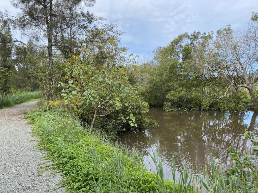
Nestled near Yandina lies the lush Yandina Creek Wetland, a birdwatcher’s paradise following the creek into Coolum Conservation Park. Park along River Road and embark on the flat, gravel track winding through this feeding ground. Shining bronze-cuckoos, laughing kookaburras and spotted pardalotes call from the foliage overhead, alongside white-cheeked honeyeaters and forest kingfishers that flash between trees.
The limited shade means sun protection is key – don your hat, slip on some sunscreen and slap on the bug spray. Mosquitoes thrive in the wetland habitat, so cover up and bring repellent.
With domestic animals prohibited, leave Fido at home and immerse yourself in the native bird serenades instead. Spend hours identifying feathery friends as you wander the calm waterway corridor in this picturesque natural setting just waiting to be explored.
Mapleton State Forest
Just 15 minutes west of Yandina lies the 2,700 hectare Mapleton State Forest, one of the best spots for rainforest immersion. Pass Mapleton town and follow signs into the forest down Old Mapleton Road.
Park and waste no time on the Main Track Loop trail. A cool respite emerges beneath the canopy filtering sunlight onto the forest floor. Vibrant ferns line towering coachwoods and gums adorned with lichen. After 20 minutes, emerge within a grove of primordial Hoop Pines, their gnarled branches twisting skyward – stop to marvel at these living legends over 400 years old. Keep eyes peeled for rainbow lorikeets and whipbirds flitting among lush undergrowth.
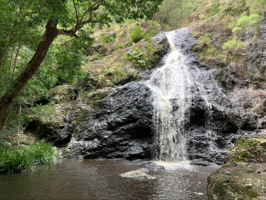
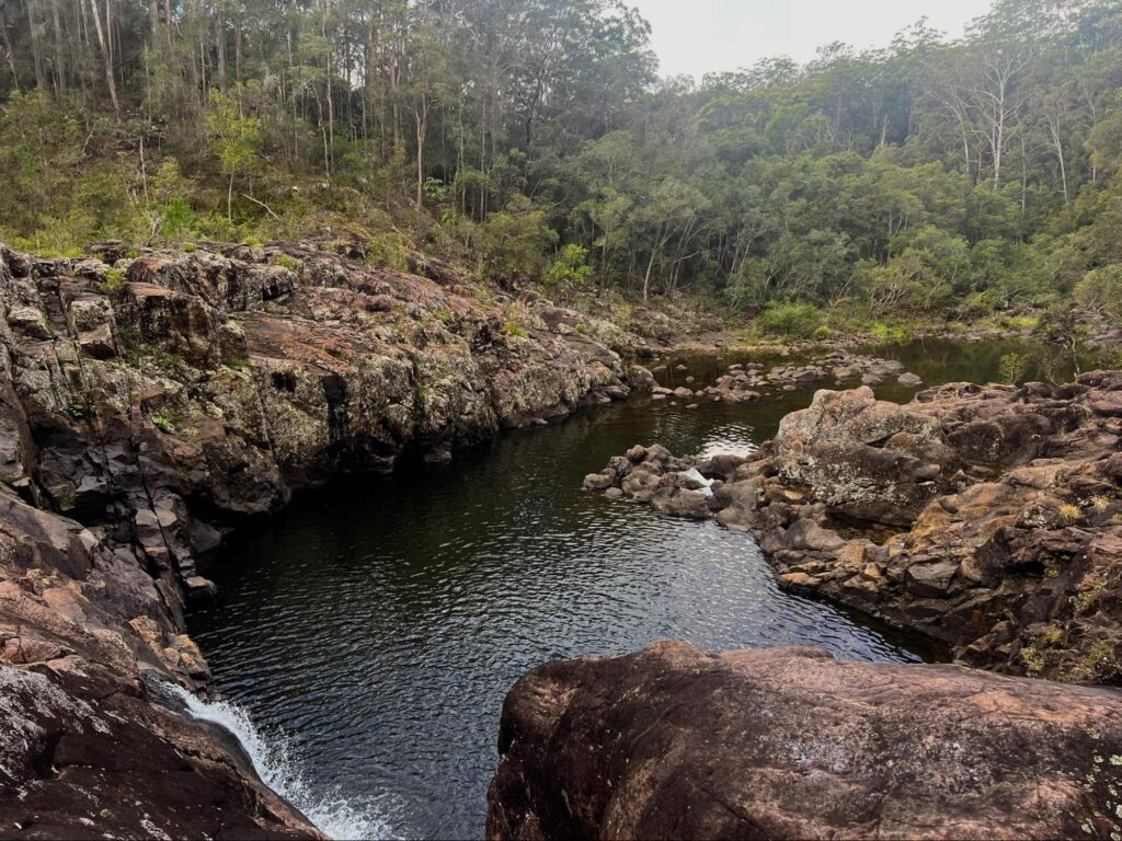
Those seeking more adventure take the 5.5km Gheerulla Falls Track. A gorgeous walk through Mapleton Falls National Park in the Sunshine Coast Region of south eastern Queensland, that is suitable for almost everyone, you’ll make a steady short descent down to Gheerulla Falls and back again. The trail itself is well sign posted and the falls are a good spot for swimming!
Mount Ninderry
The scenic 469m peak of Mount Ninderry rises prominently just 5km east of Yandina. As one of the last remaining dry eucalypt woodlands on the coast, its summit rewards hikers with sweeping coastal and hinterland views.
A short drive leads to the trailhead parking. Set off on the 6km return track winding gently through grasslands dotted with native bees and flowers. Bell miners call loudly from treetops as kingfishers flash in the distance. After 1.5km, the trail climbs steeply into gum trees. Wrinkled bark fascinates before catching your breath. Fit walkers can manage the gradients and occasional steps up loose surfaces.
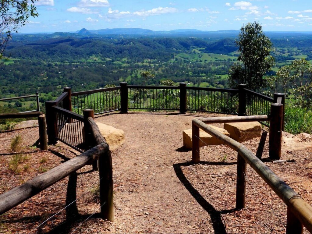
Further on, breezes begin to flow from above. Emerging onto rocky slopes, gaze south towards landmark Glass House Mountains. Follow cairns the final 20 minutes to the summit, where 360-degree panoramas stretch from coastline and farming valleys to Mount Coolum beyond. Refuel then began the scenic descent, soaking in one last glimpse of the landscape navigated by early settlers. Discover why Mount Ninderry holds cultural significance for Dreaming stories and hikers today.
Wappa Dam
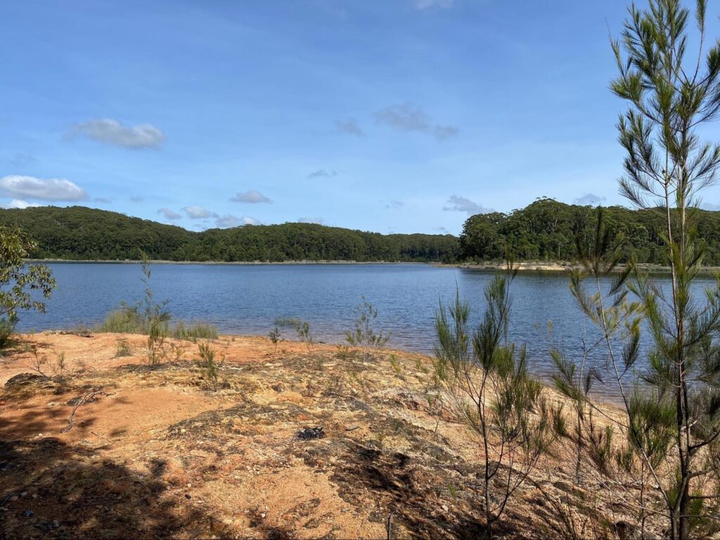
Nestled in a scenic pocket of the Mapleton Valley, just 8km northwest of Yandina town centre, lies the idyllic Wappa Dam recreation area. Winding country roads lead past rolling pastures and eucalyptus groves before a sign declares your arrival at the low-key 51 hectare park.
Pull into the ample parking overlooking tranquil Wappa Lake, its still waters reflecting surrounding mountains like a giant mirror. Grab a park map from the kiosk then set off downstream along the Lakeside Track – an easy 2km circumnavigation.
The first 30 minutes meander through sparse woodlands, with glimpses of the lake shimmering through paperbarks occasionally. Listen for whistling kites circling overhead and tiny cricket frogs chirruping in the undergrowth. Emerging onto grassy picnic lawns, take a break taking in the serenity while watching cormorants glide gracefully across the water.
Ahead, the track hugs bushland again before arriving at a secluded cove perfect for swimming on warm days. Dip your feet in the refreshingly cool water before continuing upstream to discover lookouts with scenic 180 degree views. Wedgetail eagles may soar the thermals as you appreciate the picture-perfect valley landscape all around.
Retrace your steps back to the kiosk, satisfied and re-energized after wandering beside these tranquil waters. Little wonder locals have long considered Wappa Dam one of the Sunshine Coast’s hidden gems.
Point Glorious
Nestled 14km southeast of Yandina is the remote yet rewarding Point Glorious lookout. To access this scenic spot, navigate rugged back roads winding through farms and forest patches. Set off from Yandina along Old Gympie Road, turning right at Cooloolabin Dam onto the gravel Buckby Road. Forest closes in as you bend along for 3.7km, keeping an eye out for the unmarked Point Glorious Road turn. Pass signs warning of the 4WD-only track ahead.
Park where the road deteriorates and begin the 3.7km return hike. Wind uphill through coastal scrub and woodlands dotted with bush turkeys foraging among leaf litter. Brush-tailed possums may snooze high in trees overhead. After an hour of steady climbing, emerge onto granite outcrops offering sweeping views. Hazy silhouettes of the Glass House Mountains stretch along the coast towards Bribie Island in the distance. Nearby Mt. Eewah towers prominent at 422m.
Refresh with snacks while taking in the inspiring ocean and hinterland panoramas unfolding from your lookout vantage point. Little wonder explorers have long been drawn to soak in the raw natural beauty of this scenic Sunshine Coast ridge.
Cooloolabin Dam
Nestled just 7km west of Yandina lies the scenic Cooloolabin Dam recreation area. Follow signs along quiet roads to emerge at its 138 hectare shoreline, where the expansive reservoir glistens peacefully.
Set out clockwise on the 3km Cooloolabin Circuit track passing through blackbutt and flooded gum woodlands. Fantails chatter overhead as you listen for more secretive mammals below. After 30 minutes, reach the 300m wide gravel dam wall itself.
Gaze upon the massive structure holding back 24 billion litres of water supplying coast communities. Spot cormorants and shags perched on half-submerged logs below. In the distance, the raw Conondale Ranges rise beyond farms and patches of rainforest.
Continue around the reservoir, pausing to admire stands of red-flowering carrotwoods. Watch ripples chase across the still water until completing the circuit back at picnic grounds over an hour later. Take in inspiring hinterland views and understand why early visitors also appreciated these scenic Mapleton charms.
From lush rainforest tracks to sparkling dam circuits, you really can’t go wrong in this diverse region. Whether you prefer short-but-scenic family treks or are after a multi-hour adventure with epic views as the reward, there’s something here for every ability. So grab your hat, water bottle and sturdy shoes, and get exploring these special locales. You won’t regret soaking in the raw natural beauty on your doorstep. Who knows, maybe you’ll discover your new favourite secret lookout or hidden picnic spot. The trails are waiting – now it’s time to get out there and enjoy this special patch of coastal hinterland. Happy trails!